Leeds Illustrated Map
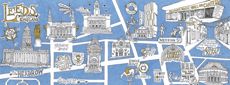
The brief for this project was to illustrate a map of a special place which would be published alongside 99 other maps of special places created by artists from across the world. With over 400 entries, my map of Leeds was chosen to be one of 100 illustrated maps within the publication. Illustrated with archival […]
Leicester Illustrated Map
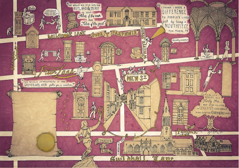
As part of Leicester City Council’s Townscape Heritage Initiative, I was commissioned to illustrate a map of the Greyfriars Conservation Area which brought to life the area’s historical past as the legal district of the city. Students from the University of Leicester collected historical sources relating to the buildings and people who make up the Greyfriars […]